
- Share
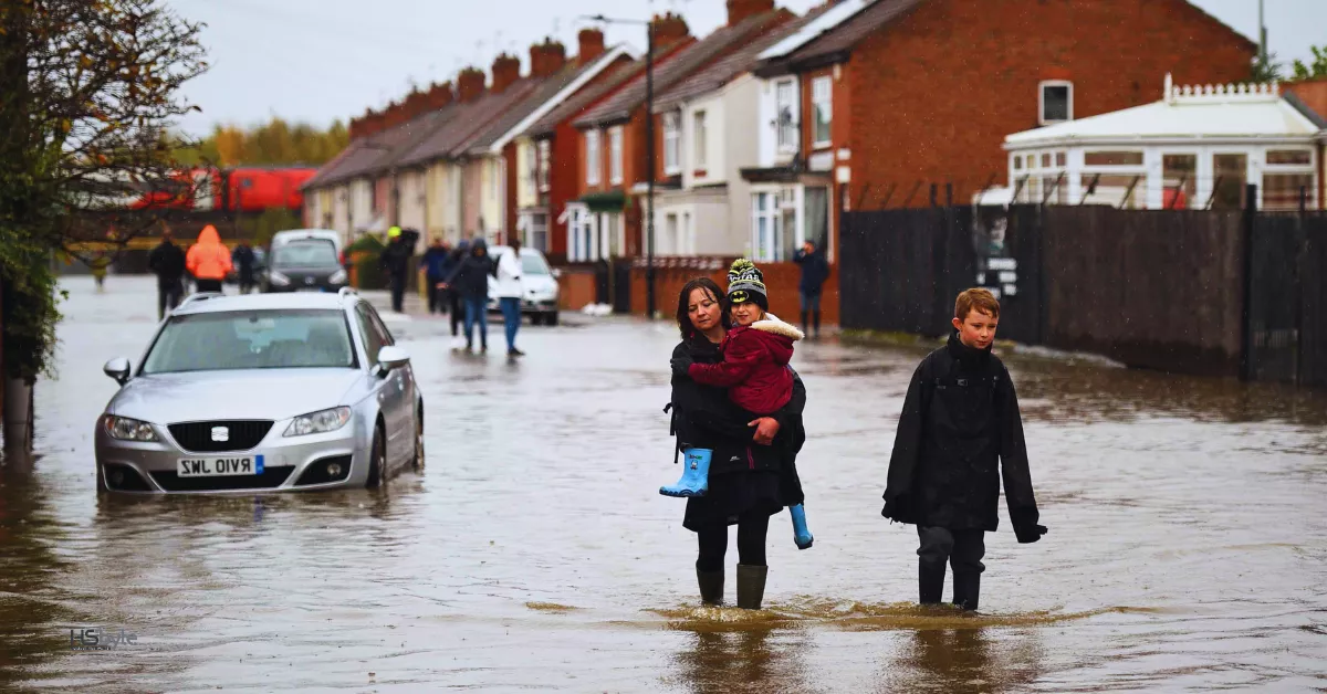
Despite a brief pause in the heavy rain, many parts of England remain on high alert for potential flooding. Over Sunday and Monday, central and southern regions saw a deluge that amounted to over a month’s worth of rainfall in just a few hours. The torrential downpour led to road closures, school shutdowns, and widespread disruption for commuters.
Though Tuesday is expected to be drier, the Environment Agency has issued over 25 flood warnings, signaling that flooding is likely, along with 65 flood alerts, indicating potential flood risks. These warnings are concentrated in areas such as Northampton, Somerset, Buckinghamshire, and Worcestershire, extending to Newport in Wales. Significant flooding threats also loom around the River Great Ouse, with river levels being carefully monitored.
Bedfordshire has been hit particularly hard, with parts of the A421 road still closed and no clear timeline for reopening. Locals have humorously dubbed the road “Bedfordshire’s new river,” as it remains submerged under floodwaters.
Train services across Kent and Sussex are also experiencing continued delays. Network Rail engineers were unable to complete critical repairs to the signaling system after parts of the railway were flooded. Additionally, Chiltern Railways reported that trains between Banbury and Bicester North are running at reduced speeds due to waterlogged tracks.

According to BBC Weather, a much-needed break from the rain will persist through Tuesday and early Wednesday, bringing periods of sunshine. However, another band of rain is expected to sweep through the country starting late Wednesday into Thursday. A yellow weather warning has been issued for parts of northern England and the north Midlands, with heavy rain forecast, particularly across the Pennines and North York Moors.
BBC Weather’s Matt Taylor offered some optimism, noting that the worst of the rain has passed, but cautioned that its impact will be felt for days. The large volume of rainfall will take time to absorb into the ground and pass through river systems, meaning water levels in some areas could continue to rise.
Over the past 48 hours, areas like Bedfordshire, Oxfordshire, Warwickshire, and Northamptonshire recorded over 100mm of rainfall. Woburn in Bedfordshire was one of the hardest hit, with 132mm (5.2 inches) of rain.
The heavy rains have also affected train services. Avanti West Coast has warned passengers that trains between Rugby and Milton Keynes Central are running at reduced speeds, with delays or cancellations possible.
While the upcoming rain is not expected to have the same impact as the recent downpours, cooler weather is forecast to grab attention later in the week. Northerly winds will drop temperatures across the UK, with southern England expected to see highs of around 16°C (61°F). As the weather system moves eastward, cooler air will begin to flow in, bringing a steady decline in temperatures. Despite the chill, it’s unlikely that frost will develop, thanks to the persistent cloud cover expected in the coming days.
You May Also Like


UK Coal Power Ends: A Bold Shift to Giant Batteries

Flood Warnings in England Severe Weather Impact Continues
Latest Update


Elon Musk’s Controversy: Shunned from UK Investment Summit


Israel Strikes Hezbollah Relentlessly Amid War Fears

Luxury Yacht Hire In Sydney: Exclusive Waterfront Charters

